Eisenhüttenstadt - Eisenhuettenstadt
Airport details
| Country | Germany |
| State | Brandenburg |
| Region | ED |
| Airspace | Bremen Ctr |
| Municipality | Siehdichum |
| Elevation | 147ft (45m) |
| Timezone | GMT +1 |
| Coordinates | 52.19733, 14.58567 |
| Magnetic var | |
| Type | land |
| Available since | X-Plane v10.40 |
| ICAO code | EDAE |
| IATA code | n/a |
| FAA code | n/a |
Communication
| Eisenhuettenstadt BERLIN INFO | 132.650 |
| Eisenhuettenstadt INFO | 122.000 |
Nearby Points of Interest:
Village church Groß Lindow
-Dorfkirche Lossow
-Village church Mixdorf
-Müllroser Mühle
-Soviet military cemetery in Cybinka
-Dorfkirche Chossewitz
-Ferdinandshof Frankfurt (Oder)
-Friedensglocke
-Rathaus Frankfurt (Oder)
-Village church Merz
-Junkerhaus
-Village church Groß Briesen
-Wohnsiedlung Paulinenhof
-Musikheim
-Altes Gaswerk Frankfurt
-Wohnpark West
-1 Wojska Polskiego Street in Słubice
-Georgenhospital Frankfurt (Oder)
-Village church Krügersdorf
-Village church Reudnitz
-St.Nicholas Andrew church in Biegen
-Village church Pillgram
-Giebellaubenhaus (Pillgram)
-Railway station Booßen
-Dorfkirche
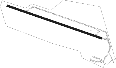
Runway info
| Runway 11 / 29 | ||
| length | 1171m (3842ft) | |
| bearing | 105° / 285° | |
| width | 23m (75ft) | |
| surface | asphalt | |
| displ threshold | 0m (0ft) / 50m (164ft) | |
Nearby beacons
| code | identifier | dist | bearing | frequency |
|---|---|---|---|---|
| FWE | FUERSTENWALDE VOR/DME | 21 | 295° | 113.30 |
Disclaimer
The information on this website is not for real aviation. Use this data with the X-Plane flight simulator only! Data taken with kind consent from X-Plane 12 source code and data files. Content is subject to change without notice.