Bautzen
Airport details
| Country | Germany |
| State | Saxony |
| Region | ED |
| Airspace | Munich Ctr |
| Municipality | Kubschütz - Kubšicy |
| Elevation | 566ft (173m) |
| Timezone | GMT +1 |
| Coordinates | 51.19152, 14.52316 |
| Magnetic var | |
| Type | land |
| Available since | X-Plane v10.40 |
| ICAO code | EDAB |
| IATA code | BBJ |
| FAA code | n/a |
Communication
| Bautzen Bautzen Info | 120.600 |
Nearby Points of Interest:
Kirche Purschwitz
-Rittergut Pommritz
-Bautzen II
-Serbski dom
-Gewandhaus
-Schiller-Gymnasium
-Röhrscheidtbastei
-Mönchsbastei
-Hofrichterhaus
-Bahnhof Großpostwitz
-Kirche Nostitz
-Bahnhof Radibor
-Schloss Unwürde
-Heinrich-Pestalozzi-Oberschule Löbau
-Rathaus Löbau
-Brücknersche Villa
-Kirche Förstgen
-Gaussig House
-Barockschloss Neschwitz
-Schloss Döbschütz
-Spremberg village church
-Rittergut Arnsdorf
-Fledermausschloss Weißig
-Kirche Friedersdorf
-Neues Schloss Uhyst
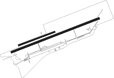
Runway info
Runway 07 / 25  | ||
| length | 2195m (7201ft) | |
| bearing | 79° / 259° | |
| width | 50m (164ft) | |
| surface | concrete | |
| Runway 07L / 25R | ||
| length | 896m (2940ft) | |
| bearing | 80° / 260° | |
| width | 35m (115ft) | |
| surface | grass | |
Nearby beacons
| code | identifier | dist | bearing | frequency |
|---|---|---|---|---|
| HDO | HERMSDORF VOR/DME | 16.8 | 210° | 108.65 |
| FS | DRESDEN NDB | 25.3 | 270° | 374 |
| OKX | FRYDLANT VOR/DME | 25.8 | 120° | 114.85 |
| DND | DME | 29 | 265° | 115.40 |
| DRN | DRESDEN VOR/DME | 36.4 | 259° | 114.35 |
| NER | NERATOVICE VOR/DME | 49.6 | 173° | 112.25 |
| V | MASLOVICE (VODOCHODY) NDB | 58.6 | 189° | 416 |
| KLF | KLASDORF VOR/DME | 61.2 | 311° | 115.15 |
Departure and arrival routes
| Transition altitude | 5000ft |
| SID end points | distance | outbound heading | |
|---|---|---|---|
| RW07 | |||
| ABLO3S | 11mi | 359° | |
| RW25 | |||
| ABLO3G | 11mi | 359° | |
Instrument approach procedures
| runway | airway (heading) | route (dist, bearing) |
|---|---|---|
| RW25 | LOBMA (333°) | LOBMA 5000ft AB458 (6mi, 81°) 4000ft AB459 (5mi, 79°) 3700ft AB439 (5mi, 335°) 3000ft |
| RNAV | AB439 3000ft BATIX (4mi, 259°) 3000ft EDAB (7mi, 259°) 580ft AB430 (7mi, 260°) (3158mi, 196°) 3000ft LOBMA (3158mi, 16°) 5000ft |
Disclaimer
The information on this website is not for real aviation. Use this data with the X-Plane flight simulator only! Data taken with kind consent from X-Plane 12 source code and data files. Content is subject to change without notice.