Zemmora - Relizane
Airport details
| Country | Algeria |
| State | Relizane |
| Region | |
| Airspace | Algiers Ctr |
| Municipality | Oued El Djemaa |
| Elevation | 282ft (86m) |
| Timezone | GMT +1 |
| Coordinates | 35.75060, 0.61898 |
| Magnetic var | |
| Type | land |
| Available since | X-Plane v10.40 |
| ICAO code | DAAZ |
| IATA code | n/a |
| FAA code | n/a |
Communication
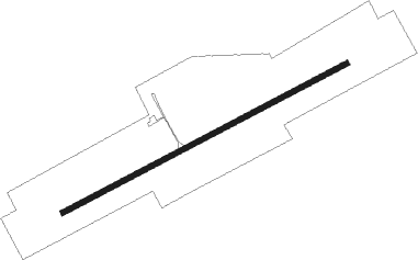
Runway info
| Runway 07 / 25 | ||
| length | 1357m (4452ft) | |
| bearing | 71° / 251° | |
| width | 21m (70ft) | |
| surface | asphalt | |
Nearby beacons
| code | identifier | dist | bearing | frequency |
|---|---|---|---|---|
| MOS | MOSTAGANEM VOR/DME | 25.1 | 287° | 112.20 |
| GRS | GHRISS NDB | 39.4 | 221° | 424 |
| GRS | GHRISS VOR | 39.8 | 221° | 113.10 |
| CLF | CHLEF VOR/DME | 44 | 57° | 117 |
| ON | BOUFATIS NDB | 47.3 | 268° | 415 |
| TRB | TIARET VOR/DME | 50 | 114° | 116.30 |
| OO | SIDI-CHAMI NDB | 56.4 | 265° | 265 |
| ORA | AHMED BENBELLA VOR/DME | 62.6 | 264° | 114 |
Disclaimer
The information on this website is not for real aviation. Use this data with the X-Plane flight simulator only! Data taken with kind consent from X-Plane 12 source code and data files. Content is subject to change without notice.