Stephen - Stephen Muni
Airport details
| Country | United States of America |
| State | Minnesota |
| Region | |
| Airspace | Minneapolis Ctr |
| Municipality | Stephen |
| Elevation | 830ft (253m) |
| Timezone | GMT -6 |
| Coordinates | 48.46499, -96.86607 |
| Magnetic var | |
| Type | land |
| Available since | X-Plane v10.40 |
| ICAO code | D41 |
| IATA code | n/a |
| FAA code | D41 |
Communication
Nearby Points of Interest:
Old Mill State Park WPA/Rustic Style Historic Resources
-Lake Bronson State Park WPA/Rustic Style Historic Resources
-St. Stanislaus Church Historic District
-Walsh County Courthouse
-Grafton State School
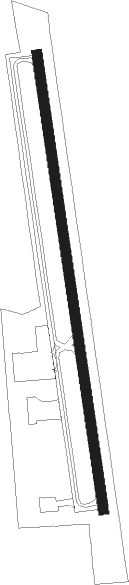
Runway info
| Runway 17 / 35 | ||
| length | 826m (2710ft) | |
| bearing | 174° / 354° | |
| width | 18m (60ft) | |
| surface | asphalt | |
Nearby beacons
| code | identifier | dist | bearing | frequency |
|---|---|---|---|---|
| HML | HUMBOLDT TACAN | 26.2 | 328° | 112.40 |
| GFK | GRAND FORKS VOR/DME | 33.1 | 212° | 114.30 |
| TVF | THIEF RIVER FALLS VOR/DME | 36 | 120° | 114.45 |
| RDR | RED RIVER (GRAND FORKS) TACAN | 37.3 | 227° | 116.40 |
| GF | HISER NDB | 39.2 | 207° | 345 |
Disclaimer
The information on this website is not for real aviation. Use this data with the X-Plane flight simulator only! Data taken with kind consent from X-Plane 12 source code and data files. Content is subject to change without notice.