Sauk Centre - Sauk Centre Muni
Airport details
| Country | United States of America |
| State | Minnesota |
| Region | K3 |
| Airspace | Minneapolis Ctr |
| Municipality | Stearns County |
| Elevation | 1244ft (379m) |
| Timezone | GMT -6 |
| Coordinates | 45.70660, -94.93325 |
| Magnetic var | |
| Type | land |
| Available since | X-Plane v10.40 |
| ICAO code | D39 |
| IATA code | n/a |
| FAA code | n/a |
Communication
| Sauk Centre Muni CTAF | 122.900 |
| Sauk Centre Muni MINNEAPOLIS CNTR | 126.100 |
Nearby Points of Interest:
Original Main Street Historic District
-Minnesota Home School for Girls Historic District
-Saint Cloud and Red River Valley Stage Road–Kandota Section
-Church of St. Boniface
-Swany White Flour Mills
-Church of the Sacred Heart
-Anton Gogala Farmstead
-Northern Pacific Depot
-Daniel Pennie House
-Christopher Borgerding House
-Todd County Courthouse, Sheriff's House, and Jail
-Bank of Long Prairie
-Batcher Opera House Block
-Hotel Reichert
-Pope County Courthouse
-Glenwood Public Library
-Church of the Immaculate Conception-Catholic
-Fremad Association Building
-Urjans Iverson House
-Great Northern Passenger Depot
-Little Falls and Dakota Depot
-John Oster House
-Eugene Hermanutz House
-Ferdinand Peters House
-First State Bank
Runway info
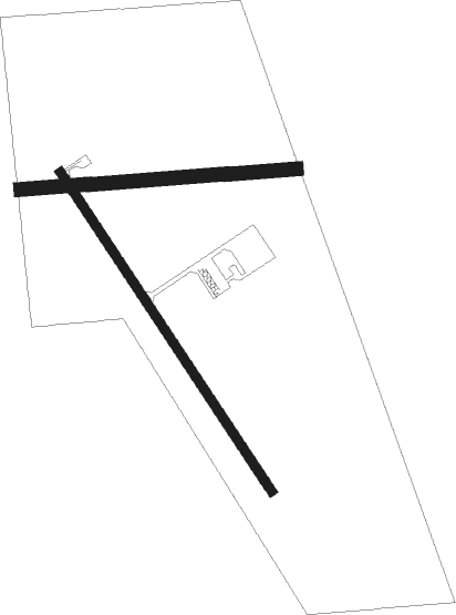
Runway 14 / 32  | ||
| length | 1006m (3301ft) | |
| bearing | 141° / 321° | |
| width | 23m (75ft) | |
| surface | asphalt | |
| Runway 08 / 26 | ||
| length | 734m (2408ft) | |
| bearing | 90° / 270° | |
| width | 37m (120ft) | |
| surface | grass | |
Nearby beacons
| code | identifier | dist | bearing | frequency |
|---|---|---|---|---|
| AXN | ALEXANDRIA VOR/DME | 19.6 | 310° | 112.80 |
| XCR | RIPLEY NDB | 33.2 | 58° | 404 |
| BDH | WILLMAR VOR/DME | 36.3 | 198° | 113.70 |
| STC | SAINT CLOUD VOR/DME | 37.9 | 100° | 112.10 |
| DWN | DARWIN VORTAC | 42.3 | 142° | 109 |
| ST | HUSSK (ST CLOUD) NDB | 42.7 | 103° | 342 |
| MVE | MONTEVIDEO VOR/DME | 54.9 | 227° | 111.60 |
| BR | LAREW (BRAINERD) NDB | 58.8 | 51° | 251 |
Instrument approach procedures
| runway | airway (heading) | route (dist, bearing) |
|---|---|---|
| RW14 | AXN (130°) | AXN ZERNU (9mi, 118°) 3000ft |
| RW14 | OBARE (263°) | OBARE ZERNU (17mi, 290°) 3000ft ZERNU (turn) 3000ft |
| RW14 | TESEE (67°) | TESEE ZERNU (11mi, 337°) 3000ft ZERNU (turn) 3000ft |
| RW14 | ULJAB (93°) | ULJAB ZERNU (11mi, 46°) 3100ft ZERNU (turn) 3000ft |
| RNAV | ZERNU 3000ft YIKVU (6mi, 141°) 2900ft WETUB (3mi, 141°) 1940ft D39 (2mi, 140°) 1280ft (5612mi, 116°) 1492ft VOCAB (5607mi, 296°) 3000ft VOCAB (turn) | |
| RW32 | ARMUW (45°) | ARMUW VOCAB (18mi, 76°) 3000ft VOCAB (turn) 3000ft |
| RW32 | DWN (322°) | DWN VOCAB (31mi, 322°) 3000ft |
| RW32 | TLBAT (282°) | TLBAT WINIV (11mi, 266°) 3300ft VOCAB (9mi, 266°) 3000ft |
| RNAV | VOCAB 3000ft BANVY (6mi, 322°) 2800ft IYACA (3mi, 322°) 1840ft D39 (2mi, 323°) 1280ft (5612mi, 116°) 1492ft ZERNU (5617mi, 296°) 3000ft ZERNU (turn) |
Disclaimer
The information on this website is not for real aviation. Use this data with the X-Plane flight simulator only! Data taken with kind consent from X-Plane 12 source code and data files. Content is subject to change without notice.