Lake Isabella - Lake Isabella Airpark
Airport details
| Country | United States of America |
| State | Michigan |
| Region | |
| Airspace | Minneapolis Ctr |
| Municipality | Lake Isabella |
| Elevation | 886ft (270m) |
| Timezone | GMT -5 |
| Coordinates | 43.64526, -84.98743 |
| Magnetic var | |
| Type | land |
| Available since | X-Plane v10.40 |
| ICAO code | D15 |
| IATA code | n/a |
| FAA code | D15 |
Communication
| Lake Isabella Airpark CTAF | 122.800 |
Nearby Points of Interest:
Sherman City Union Church
-Mount Pleasant Indian Industrial Boarding School
-Michigan Condensed Milk Factory
-Mount Pleasant Downtown Historic District
-Doughty House (Mount Pleasant, Michigan)
-George and Martha Hitchcock House
-Lincoln Road–Pine River Bridge
-MacLachlan Sanitarium
-Alma Downtown Historic District
-Wright Opera House
-Giles Gilbert House
-Nisbett Building
-Fairman Building
-Ithaca Downtown Historic District
-Gratiot County Courthouse
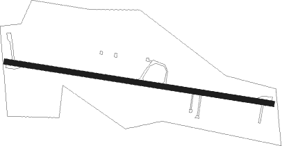
Runway info
| Runway 11 / 29 | ||
| length | 788m (2585ft) | |
| bearing | 100° / 280° | |
| width | 15m (50ft) | |
| surface | asphalt | |
| displ threshold | 332m (1089ft) / 219m (719ft) | |
Nearby beacons
| code | identifier | dist | bearing | frequency |
|---|---|---|---|---|
| MOP | MOUNT PLEASANT VOR/DME | 10.9 | 95° | 110.60 |
| HIC | WHITE CLOUD VOR/DME | 31.9 | 264° | 117.60 |
| MB | OLSTE (SAGINAW) NDB | 36.8 | 103° | 257 |
| MBS | SAGINAW VOR/DME | 40.1 | 97° | 112.90 |
| MA | WEXOR (CADILLAC) NDB | 43 | 317° | 336 |
| GR | KNOBS (GRAND RAPIDS) NDB | 48.1 | 208° | 263 |
| VIO | VICTORY VOR/DME | 56.1 | 211° | 115.95 |
Disclaimer
The information on this website is not for real aviation. Use this data with the X-Plane flight simulator only! Data taken with kind consent from X-Plane 12 source code and data files. Content is subject to change without notice.