Bathurst
Airport details
| Country | Canada |
| State | New Brunswick |
| Region | CY |
| Airspace | Moncton Ctr |
| Municipality | Bathurst Parish |
| Elevation | 189ft (58m) |
| Timezone | GMT -4 |
| Coordinates | 47.62961, -65.73896 |
| Magnetic var | |
| Type | land |
| Available since | X-Plane v10.40 |
| ICAO code | CZBF |
| IATA code | ZBF |
| FAA code | n/a |
Communication
| Bathurst CTAF/UNICOM | 122.800 |
Runway info
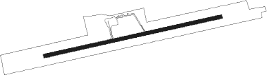
| Runway 10 / 28 | ||
| length | 1708m (5604ft) | |
| bearing | 85° / 265° | |
| width | 33m (108ft) | |
| surface | asphalt | |
| displ threshold | 142m (466ft) / 0m (0ft) | |
Nearby beacons
| code | identifier | dist | bearing | frequency |
|---|---|---|---|---|
| 1F | BATHURST NDB | 0.2 | 280° | 363 |
| F9 | MIRAMICHI NDB | 38.8 | 156° | 520 |
Instrument approach procedures
| runway | airway (heading) | route (dist, bearing) |
|---|---|---|
| RW10 | EMPOK (67°) | EMPOK IKBUK (5mi, 348°) 2500ft |
| RW10 | TEVAV (101°) | TEVAV IKBUK (5mi, 168°) 2500ft |
| RNAV | IKBUK 2500ft APLIV (6mi, 84°) 1700ft ESPUT (2mi, 85°) 910ft CZBF (3mi, 85°) 243ft OTETO (5mi, 85°) 3300ft OTETO (turn) | |
| RW28 | IKDEG (246°) | IKDEG EMIKA (5mi, 168°) 1600ft |
| RW28 | UDNUX (282°) | UDNUX EMIKA (5mi, 349°) 1600ft |
| RNAV | EMIKA 1600ft APLUP (6mi, 265°) 1600ft CZBF (5mi, 265°) 228ft AVEBA (5mi, 265°) 3200ft AVEBA (turn) |
Disclaimer
The information on this website is not for real aviation. Use this data with the X-Plane flight simulator only! Data taken with kind consent from X-Plane 12 source code and data files. Content is subject to change without notice.