Port Hawkesbury
Airport details
| Country | Canada |
| State | Nova Scotia |
| Region | CY |
| Airspace | Moncton Ctr |
| Municipality | Port Hastings |
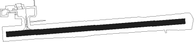
| Elevation | 376ft (115m) |
| Timezone | GMT -4 |
| Coordinates | 45.65650, -61.36837 |
| Magnetic var | |
| Type | land |
| Available since | X-Plane v10.40 |
| ICAO code | CYPD |
| IATA code | YPS |
| FAA code | n/a |
Communication
| PORT HAWKESBURY CTAF/UNICOM | 122.800 |
Nearby Points of Interest:
Battery Provincial Park
-St. Peters Canal
-Fort William Augustus
Instrument approach procedures
| runway | airway (heading) | route (dist, bearing) |
|---|---|---|
| RW11 | IMELO (82°) | IMELO DUVUR (5mi, 21°) 2200ft |
| RW11 | XUDAB (119°) | XUDAB DUVUR (5mi, 201°) 2200ft |
| RNAV | DUVUR 2200ft EBKIG (5mi, 100°) 2130ft XOVOG (2mi, 100°) 1330ft XEROK (2mi, 100°) 535ft DUVIX (5mi, 101°) 2600ft DUVIX (turn) | |
| RW29 | LIBIK (252°) | LIBIK IGVAT (5mi, 180°) 2100ft |
| RW29 | XESEP (289°) | XESEP IGVAT (5mi, 0°) 2100ft |
| RNAV | IGVAT 2100ft DUTIT (5mi, 270°) 2020ft CYPD (5mi, 270°) 423ft VISOX (5mi, 273°) 2600ft VISOX (turn) |
Disclaimer
The information on this website is not for real aviation. Use this data with the X-Plane flight simulator only! Data taken with kind consent from X-Plane 12 source code and data files. Content is subject to change without notice.