Brantford
Airport details
| Country | Canada |
| State | Ontario |
| Region | CY |
| Airspace | Toronto Ctr |
| Municipality | Brant County |
| Elevation | 812ft (247m) |
| Timezone | GMT -5 |
| Coordinates | 43.13238, -80.34152 |
| Magnetic var | |
| Type | land |
| Available since | X-Plane v10.40 |
| ICAO code | CYFD |
| IATA code | YFD |
| FAA code | n/a |
Communication
| Brantford CTAF/UNICOM | 122.825 |
Nearby Points of Interest:
Galt railway station
-Old Woodstock Town Hall
-Burlington Heights
-Cliff Site
-Hamilton City Hall
-Victoria Hall
-Former Hamilton Customs House
-Ruthven Park
-Annandale National Historic Site
-Nanticoke Generating Station
-Hamilton Waterworks
-Crawford Lake Conservation Area
-Erland Lee Museum
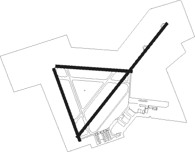
Runway info
Runway 17 / 35  | ||
| length | 794m (2605ft) | |
| bearing | 159° / 339° | |
| width | 30m (100ft) | |
| surface | asphalt | |
| Runway 05 / 23 | ||
| length | 1526m (5007ft) | |
| bearing | 52° / 232° | |
| width | 30m (100ft) | |
| surface | asphalt | |
| Runway 11 / 29 | ||
| length | 789m (2589ft) | |
| bearing | 96° / 276° | |
| width | 30m (100ft) | |
| surface | asphalt | |
Nearby beacons
| code | identifier | dist | bearing | frequency |
|---|---|---|---|---|
| FD | BRANTFORD NDB | 4.8 | 232° | 207 |
| ZHA | ANCASTER (HAMILTON) NDB | 14.2 | 78° | 397 |
| HM | HAMILTON NDB | 14.6 | 92° | 221 |
| WT | (KITCHENER) DME | 19.6 | 353° | 115 |
| ZKF | WELLINGTON (KITCHENER) NDB | 21.7 | 9° | 335 |
| ZHM | BINBROOK (HAMILTON) NDB | 24 | 89° | 266 |
| YXU | LONDON VOR/DME | 35.8 | 263° | 117.20 |
| YTP | PEARSON (TORONTO) VOR/DME | 43.8 | 51° | 116.55 |
| YYZ | TORONTO VOR/DME | 44.2 | 53° | 112.15 |
| ZYZ | QUEENSWAY (TORONTO) NDB | 45.3 | 58° | 368 |
| ZTO | WOODHILL (TORONTO) NDB | 45.8 | 46° | 403 |
| TZ | GIBRALTAR POINT NDB | 50.7 | 63° | 257 |
Instrument approach procedures
| runway | airway (heading) | route (dist, bearing) |
|---|---|---|
| RW05 | ALPOG (25°) | ALPOG OVUTU (5mi, 304°) 2500ft |
| RW05 | MIBLA (73°) | MIBLA OVUTU (5mi, 124°) 2500ft |
| RNAV | OVUTU 2500ft SEKIL (6mi, 52°) 2400ft CYFD (5mi, 51°) 858ft URNEK (5mi, 52°) 3200ft URNEK (turn) | |
| RW23 | LETOT (203°) | LETOT UKIMI (5mi, 124°) 2500ft |
| RW23 | LISPO (254°) | LISPO UKIMI (5mi, 304°) 2500ft |
| RNAV | UKIMI 2500ft KIPAB (5mi, 232°) 2450ft VESBU (3mi, 232°) 1500ft CYFD (2mi, 233°) 860ft OBRIP (5mi, 231°) 3200ft OBRIP (turn) |
Disclaimer
The information on this website is not for real aviation. Use this data with the X-Plane flight simulator only! Data taken with kind consent from X-Plane 12 source code and data files. Content is subject to change without notice.