Enterprise - Enterprise Muni
Airport details
| Country | United States of America |
| State | Oregon |
| Region | K1 |
| Airspace | Seattle Ctr |
| Municipality | Wallowa County |
| Elevation | 3957ft (1206m) |
| Timezone | GMT -8 |
| Coordinates | 45.42500, -117.26500 |
| Magnetic var | |
| Type | land |
| Available since | X-Plane v10.40 |
| ICAO code | 8S4 |
| IATA code | n/a |
| FAA code | 8S4 |
Communication
| Enterprise Muni CTAF/Unicom | 122.800 |
Nearby Points of Interest:
William P. Warnock House
-Burnaugh Building
-Enterprise Mercantile and Milling Company Building
-OK Theatre
-Wallowa County Chieftain Building
-Flora School
-Dr. J. W. Barnard Building and First National Bank of Joseph
-Lostine Pharmacy
-Zumwalt Prairie
-Hunter–Morelock House
-Wallowa Ranger Station
-Lick Creek Guard Station
-College Creek Ranger Station
-Ascension Episcopal Church
-Cornucopia Jailhouse
-Billy Meadows Guard Station
-Abel E. Eaton House
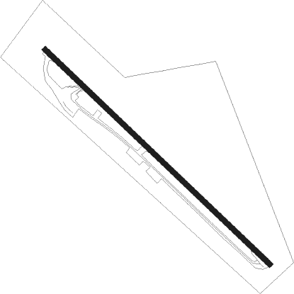
Runway info
| Runway 12 / 30 | ||
| length | 869m (2851ft) | |
| bearing | 128° / 308° | |
| width | 15m (50ft) | |
| surface | asphalt | |
Nearby beacons
| code | identifier | dist | bearing | frequency |
|---|---|---|---|---|
| LGD | LA GRANDE NDB | 29.8 | 263° | 296 |
| BKE | BAKER CITY VOR/DME | 41.9 | 223° | 115.30 |
| IDQ | DME | 51 | 51° | 115.65 |
| AL | TRINA (WALLA WALLA) NDB | 59.6 | 309° | 353 |
| MQG | NEZ PERCE (LEWISTON) VOR/DME | 59.7 | 22° | 108.20 |
Disclaimer
The information on this website is not for real aviation. Use this data with the X-Plane flight simulator only! Data taken with kind consent from X-Plane 12 source code and data files. Content is subject to change without notice.