Rosalia - Rosalia Muni
Airport details
| Country | United States of America |
| State | Washington |
| Region | |
| Airspace | Seattle Ctr |
| Municipality | Rosalia |
| Elevation | 2168ft (661m) |
| Timezone | GMT -8 |
| Coordinates | 47.23357, -117.42495 |
| Magnetic var | |
| Type | land |
| Available since | X-Plane v10.40 |
| ICAO code | 72S |
| IATA code | n/a |
| FAA code | 72S |
Communication
Nearby Points of Interest:
Central Service Station
-Rosalia Railroad Bridge
-Cheney Odd Fellows Hall
-Manning-Rye Covered Bridge
-Coeur d'Alene Mission of the Sacred Heart
-Holy Trinity Episcopal Church
-Cambern Dutch Shop Windmill
-Coolidge–Rising House
-Breslin
-Knickerbocker
-Frequency Changing Station
-Edward and Ida Soncarty Barn
-Patsy Clark Mansion
-Eldridge Building
-Amman
-Riverside Avenue Historic District
-Review Building
-Spokane Public Library - East Side Branch
-Peyton Building and Peyton Annex
-The Globe Hotel
-Spokane City Hall Building
-Kemp & Hebert Building
-Grace Baptist Church
-John A. Finch Memorial Nurses Home
-Spokane Fire Station No. 3
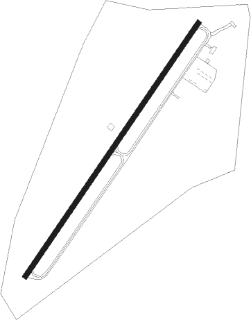
Runway info
| Runway 2 / 20 | ||
| length | 856m (2808ft) | |
| bearing | 50° / 230° | |
| width | 14m (45ft) | |
| surface | asphalt | |
| displ threshold | 51m (167ft) / 41m (135ft) | |
Nearby beacons
| code | identifier | dist | bearing | frequency |
|---|---|---|---|---|
| GEG | SPOKANE VORTAC | 21.5 | 329° | 115.50 |
| SKA | FAIRCHILD (SPOKANE) TACAN | 24.5 | 328° | 111.40 |
| PUW | PULLMAN (PULLMAN/MOSCOW) VOR/DME | 34.5 | 160° | 109 |
| COE | COEUR D'ALENE VOR/DME | 40.6 | 48° | 108.80 |
| DPY | DEER PARK NDB | 44 | 360° | 365 |
| MQG | NEZ PERCE (LEWISTON) VOR/DME | 56 | 147° | 108.20 |
Disclaimer
The information on this website is not for real aviation. Use this data with the X-Plane flight simulator only! Data taken with kind consent from X-Plane 12 source code and data files. Content is subject to change without notice.