Brooten - Brooten Muni
Airport details
| Country | United States of America |
| State | Minnesota |
| Region | K3 |
| Airspace | Minneapolis Ctr |
| Municipality | Brooten |
| Elevation | 1305ft (398m) |
| Timezone | GMT -6 |
| Coordinates | 45.49705, -95.10421 |
| Magnetic var | |
| Type | land |
| Available since | X-Plane v10.40 |
| ICAO code | 6D1 |
| IATA code | n/a |
| FAA code | n/a |
Communication
| Brooten Muni CTAF | 122.900 |
Nearby Points of Interest:
Christopher Borgerding House
-Urjans Iverson House
-Monson Lake State Park CCC/WPA/Rustic Style Historic Resources
-Northern Pacific Depot
-Glenwood Public Library
-Pope County Courthouse
-Fremad Association Building
-Original Main Street Historic District
-Daniel Pennie House
-Church of St. Boniface
-Minnesota Home School for Girls Historic District
-Saint Cloud and Red River Valley Stage Road–Kandota Section
-Little Falls and Dakota Depot
-Swany White Flour Mills
-Church of the Sacred Heart
-Sabin S. Murdock House
-Church of St. Bridget-Catholic
-Church of St. Francis Xavier
-Anton Gogala Farmstead
-Christ Episcopal Church
-Great Northern Passenger Depot
-Church of the Immaculate Conception-Catholic
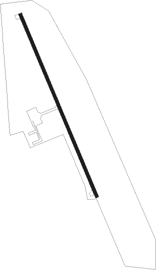
Runway info
| Runway 15 / 33 | ||
| length | 1068m (3504ft) | |
| bearing | 155° / 335° | |
| width | 18m (60ft) | |
| surface | asphalt | |
Nearby beacons
| code | identifier | dist | bearing | frequency |
|---|---|---|---|---|
| BDH | WILLMAR VOR/DME | 22.8 | 183° | 113.70 |
| AXN | ALEXANDRIA VOR/DME | 28.2 | 344° | 112.80 |
| MOX | MORRIS VOR/DME | 36.6 | 275° | 109.60 |
| DWN | DARWIN VORTAC | 36.8 | 122° | 109 |
| MVE | MONTEVIDEO VOR/DME | 40.6 | 229° | 111.60 |
| XCR | RIPLEY NDB | 47.3 | 53° | 404 |
| FF | HAMRE (FERGUS FALLS) NDB | 58.9 | 307° | 337 |
| GB | GARNO (MARSHALL) NDB | 68.8 | 219° | 253 |
Disclaimer
The information on this website is not for real aviation. Use this data with the X-Plane flight simulator only! Data taken with kind consent from X-Plane 12 source code and data files. Content is subject to change without notice.