Royce City - Bishop Field
Airport details
| Country | United States of America |
| State | Texas |
| Region | |
| Airspace | Ft Worth Ctr |
| Municipality | Hunt County |
| Elevation | 547ft (167m) |
| Timezone | GMT -6 |
| Coordinates | 32.86931, -96.28909 |
| Magnetic var | |
| Type | land |
| Available since | X-Plane v10.40 |
| ICAO code | 68TS |
| IATA code | n/a |
| FAA code | 68TS |
Communication
| Bishop Field UNICOM | 122.700 |
Nearby Points of Interest:
Porter Farm
-Royse City Lodge No. 663 A.F. & A.M.
-Warren-Crowell House
-Matthew Cartwright House
-First Methodist Church of Rockwall
-Stephen Decatur Lawrence Farmstead
-Farmersville Masonic Lodge No. 214, A.F. and A.M.
-Katy Depot
-Post Office Building
-Dallas Fire Station No. 16
-Allen Water Station
-Swiss Avenue, Dallas
-Munger Place Historic District, Dallas
-Fair Park
-Wheatley Place, Dallas
-Hyer Hall
-Central Congregational Church
-Dallas Hall
-Chevrolet Motor Company Building
-Perkins Administration Building
-Snider Hall
-Fred Florence Hall
-South Boulevard–Park Row Historic District
-Greenway Parks Historic District
-Wilson Block
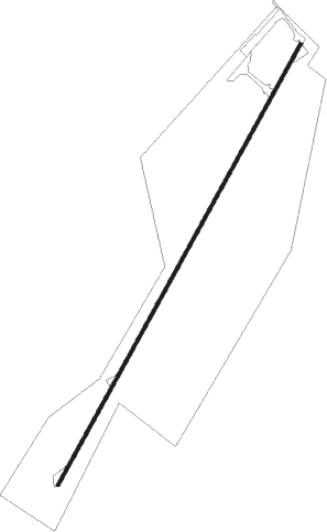
Runway info
| Runway 2 / 20 | ||
| length | 1368m (4488ft) | |
| bearing | 38° / 218° | |
| width | 9m (31ft) | |
| surface | asphalt | |
Nearby beacons
| code | identifier | dist | bearing | frequency |
|---|---|---|---|---|
| PQF | MESQUITE NDB | 12.6 | 256° | 248 |
| MJF | ARVILLA (GREENVILLE) TACAN | 16.4 | 49° | 109.60 |
| GV | MAJOR (GREENVILLE) NDB | 20.6 | 38° | 201 |
| CVE | COWBOY (DALLAS) VOR/DME | 31 | 272° | 116.20 |
| TTT | MAVERICK VOR/DME | 37.9 | 270° | 113.10 |
| BYP | BONHAM VORTAC | 40.2 | 5° | 114.60 |
| CQY | CEDAR CREEK VORTAC | 41.2 | 174° | 114.80 |
| SLR | SULPHUR SPRINGS VOR/DME | 42.4 | 66° | 109 |
| FUZ | RANGER (DALLAS-FORT WORTH VORTAC | 44.9 | 271° | 115.70 |
| UIM | DME | 46.5 | 89° | 114 |
| CGQ | POWELL (CORSICANA) NDB | 48.8 | 190° | 344 |
| CRS | CORSICANA NDB | 50.7 | 187° | 396 |
| CSZ | CROSSROADS NDB | 51.2 | 158° | 215 |
| DT | PINCK (DENTON) NDB | 51.9 | 295° | 257 |
| TYR | TYLER VOR/DME | 54.3 | 120° | 114.20 |
| PRX | PARIS VOR/DME | 58.4 | 51° | 113.60 |
| DNI | DENISON (SHERMAN-DENISON) NDB | 60.5 | 338° | 341 |
| FZT | FRANKSTON VOR/DME | 61.2 | 136° | 111.40 |
Disclaimer
The information on this website is not for real aviation. Use this data with the X-Plane flight simulator only! Data taken with kind consent from X-Plane 12 source code and data files. Content is subject to change without notice.