Fuquay-varina - Triple W
Airport details
| Country | United States of America |
| State | North Carolina |
| Region | K7 |
| Airspace | Washington Ctr |
| Municipality | Wake County |
| Elevation | 244ft (74m) |
| Timezone | GMT -5 |
| Coordinates | 35.62039, -78.70028 |
| Magnetic var | |
| Type | land |
| Available since | X-Plane v10.40 |
| ICAO code | 5W5 |
| IATA code | n/a |
| FAA code | n/a |
Communication
| Triple W CTAF/UNICOM | 122.700 |
Nearby Points of Interest:
J. Beale Johnson House
-Kemp B. Johnson House
-Fuquay-Varina Woman's Club Clubhouse
-Fuquay Springs Teacherage
-Fuquay Springs Historic District
-Jesse Penny House and Outbuildings
-Fuquay Mineral Spring
-Holly Springs Masonic Lodge
-Leslie-Alford-Mims House
-Williams Grove School
-Raleigh Water Works and E.B. Bain Water Treatment Plant
-Caraleigh Mills
-Dix Hill
-Estey Hall
-Rogers-Bagley-Daniels-Pegues House
-Montfort Hall
-East Raleigh-South Park Historic District
-Masonic Temple Building
-Joel Lane House
-Depot Historic District
-Lumsden-Boone Building
-Mahler and Carolina Trust Buildings
-Briggs Hardware Building
-Fayetteville Street Historic District
-Raleigh Water Tower
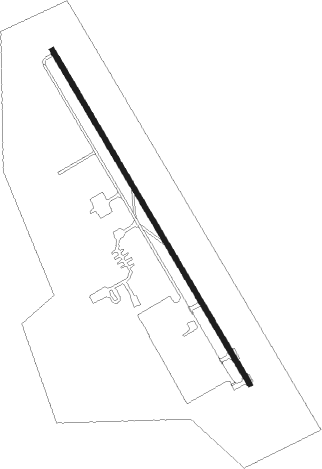
Runway info
| Runway 16 / 34 | ||
| length | 915m (3002ft) | |
| bearing | 149° / 329° | |
| width | 12m (40ft) | |
| surface | asphalt | |
Nearby beacons
| code | identifier | dist | bearing | frequency |
|---|---|---|---|---|
| HQT | HARNETT (ERWIN) NDB | 11.3 | 172° | 417 |
| RDU | RALEIGH-DURHAM VORTAC | 15.6 | 342° | 117.20 |
| JN | JURLY (SMITHFIELD) NDB | 16 | 118° | 263 |
| LE | LEEVY (RALEIGH/DURHAM) NDB | 18.4 | 356° | 350 |
| POB | POPE (FAYETTEVILLE) NDB | 26.7 | 213° | 338 |
| FGP | FORT BRAGG NDB | 29.4 | 193° | 393 |
| POB | POPE (FAYETTEVILLE) TACAN | 31.3 | 215° | 113.80 |
| FAY | FAYETTEVILLE VOR/DME | 39 | 195° | 108.80 |
| GSB | SEYMOUR JOHNSON TACAN | 39.5 | 111° | 116.50 |
| HUR | PERSON (ROXBORO) NDB | 40.8 | 329° | 220 |
| HXO | HUNTSBORO (OXFORD) NDB | 41 | 7° | 271 |
| CTZ | CLINTON NDB | 42.1 | 152° | 412 |
| LIB | LIBERTY VORTAC | 45.9 | 282° | 113 |
| HB | ALAMM NDB | 48.1 | 292° | 361 |
| SDZ | SANDHILLS (SOUTHERN PINES VORTAC | 49.7 | 245° | 111.80 |
| TYI | TAR RIVER (ROCKY MOUNT) VORTAC | 53 | 70° | 117.80 |
| ME | MAXTN (MAXTON) NDB | 64.5 | 220° | 257 |
| DAN | DANVILLE VOR | 64.7 | 326° | 113.10 |
| OA | ELLAS (JACKSONVILLE) NDB | 71.5 | 131° | 261 |
Disclaimer
The information on this website is not for real aviation. Use this data with the X-Plane flight simulator only! Data taken with kind consent from X-Plane 12 source code and data files. Content is subject to change without notice.