Rushford - Rushford Muni
Airport details
| Country | United States of America |
| State | Minnesota |
| Region | K3 |
| Airspace | Minneapolis Ctr |
| Municipality | Rushford Village |
| Elevation | 1209ft (369m) |
| Timezone | GMT -6 |
| Coordinates | 43.81583, -91.83009 |
| Magnetic var | |
| Type | land |
| Available since | X-Plane v10.40 |
| ICAO code | 55Y |
| IATA code | n/a |
| FAA code | n/a |
Communication
| Rushford Muni CTAF | 122.900 |
Nearby Points of Interest:
Inspiration Point Wayside Rest
-Benjamin Ellsworth House
-Trinity Episcopal Church (Stockton, Minnesota)
-Whitewater Avenue Commercial Historic District
-Trinity Episcopal Church
-Schech Mill
-Lenora Methodist Episcopal Church
-Ellen Lovell House
-George Haven House
-Sugar Loaf Brewery
-Chatfield Public Library
-Winona and St. Peter Engine House
-Dr. J. W. S. Gallagher House
-Watkins Manor House
-Abner F. Hodgins House
-Laird, Norton Company Building
-Winona Public Library
-Winona Masonic Temple
-Huff–Lamberton House
-Winona Savings Bank Building
-Grain and Lumber Exchange Building
-Winona City Hall
-Winona County Courthouse
-Schlitz Hotel
-Choate Department Store
Runway info
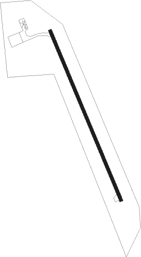
| Runway 16 / 34 | ||
| length | 977m (3205ft) | |
| bearing | 155° / 335° | |
| width | 18m (60ft) | |
| surface | asphalt | |
Nearby beacons
| code | identifier | dist | bearing | frequency |
|---|---|---|---|---|
| ODI | NODINE VORTAC | 16.7 | 75° | 117.90 |
| LSE | CROSSE DME | 25.1 | 84° | 108.40 |
| LS | MINDI (LA CROSSE) NDB | 27.1 | 72° | 272 |
| RST | ROCHESTER VOR/DME | 33.3 | 268° | 112 |
| UKN | DME | 34.6 | 151° | 116.60 |
| IY | CHUKK (CHARLES CITY) NDB | 56.6 | 233° | 417 |
| RG | REGUE (RED WING) NDB | 58.6 | 314° | 274 |
Instrument approach procedures
| runway | airway (heading) | route (dist, bearing) |
|---|---|---|
| RW34 | FALAR (307°) | FALAR NASNY (8mi, 304°) 3000ft JADDU (5mi, 256°) 2800ft |
| RW34 | JADDU (335°) | JADDU 2800ft |
| RW34 | PEDSY (7°) | PEDSY JADDU (5mi, 76°) 2800ft |
| RNAV | JADDU 2800ft FEEGS (6mi, 335°) 2800ft JIMSI (3mi, 335°) 1960ft 55Y (3mi, 335°) 1233ft (5484mi, 116°) 1611ft HIMBO (5486mi, 296°) DLANY (10mi, 262°) 3000ft DLANY (turn) |
Disclaimer
The information on this website is not for real aviation. Use this data with the X-Plane flight simulator only! Data taken with kind consent from X-Plane 12 source code and data files. Content is subject to change without notice.