Neligh - Antelope Co
Airport details
| Country | United States of America |
| State | Nebraska |
| Region | K3 |
| Airspace | Minneapolis Ctr |
| Municipality | Antelope County |
| Elevation | 1735ft (529m) |
| Timezone | GMT -6 |
| Coordinates | 42.11225, -98.03978 |
| Magnetic var | |
| Type | land |
| Available since | X-Plane v10.32 |
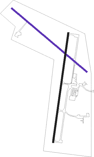
| ICAO code | 4V9 |
| IATA code | n/a |
| FAA code | n/a |
Communication
| Antelope Co CTAF/UNICOM | 122.800 |
Nearby Points of Interest:
Kester Planing Mill
-St. Peter's Episcopal Church
-Gates College Gymnasium
-Maybury–McPherson House
-Elkhorn River Bridge
-Warrick House
-Verdigris Creek Bridge
-Petersburg Jail
-Willow Creek Bridge
-Fremont, Elkhorn and Missouri Valley Railroad Depot
-Plainview Carnegie Library
-Ashfall Fossil Beds
-A.T. Ranch Headquarters
-Winnetoon Jail
-United States Post Office
-Former Wheeler County Courthouse
-Norfolk Carnegie Library
-Karl Stefan Memorial Airport Administration Building
-United States Post Office and Courthouse
-Norfolk Community Theatre
-Z.C.B.J. Opera House
-First Presbyterian Church

Nearby beacons
| code | identifier | dist | bearing | frequency |
|---|---|---|---|---|
| OFK | NORFOLK VOR/DME | 28 | 102° | 109.60 |
| ONL | O'NEILL VORTAC | 35.9 | 299° | 113.90 |
| OBH | WOLBACH VORTAC | 46.4 | 203° | 114.80 |
| PLT | PLATTE CENTER (COLUMBUS) NDB | 47.2 | 133° | 407 |
| ODX | ORD NDB | 50.1 | 242° | 356 |
| OLU | COLUMBUS VOR/DME | 50.6 | 133° | 111.80 |
| YK | CAGUR (YANKTON) NDB | 54.7 | 45° | 347 |
| YKN | YANKTON VOR/DME | 56.4 | 39° | 111.40 |
| AGZ | WAGNER NDB | 58.2 | 345° | 392 |
Instrument approach procedures
| runway | airway (heading) | route (dist, bearing) |
|---|---|---|
| RW01 | CAGOD (44°) | CAGOD 4400ft HEMED (5mi, 99°) 4400ft |
| RW01 | HEMED (16°) | HEMED 4400ft |
| RW01 | PLACA (346°) | PLACA 4400ft HEMED (5mi, 279°) 4400ft |
| RNAV | HEMED 4400ft FERUG (6mi, 17°) 3400ft OCOBO (2mi, 17°) 2600ft 4V9 (3mi, 15°) 1815ft MODPY (11mi, 17°) 4400ft MODPY (turn) | |
| RW19 | ENEYA (225°) | ENEYA 4400ft MODPY (5mi, 279°) 4400ft |
| RW19 | MODPY (197°) | MODPY 4400ft |
| RW19 | PIVEE (166°) | PIVEE 4400ft MODPY (5mi, 99°) 4400ft |
| RNAV | MODPY 4400ft AMDIZ (6mi, 197°) 3400ft 4V9 (5mi, 197°) 1772ft HEMED (12mi, 196°) 4400ft HEMED (turn) |
Disclaimer
The information on this website is not for real aviation. Use this data with the X-Plane flight simulator only! Data taken with kind consent from X-Plane 12 source code and data files. Content is subject to change without notice.