Cedar Park - Breakaway Park
Airport details
| Country | United States of America |
| State | Texas |
| Region | |
| Airspace | Houston Oceanic Ctr |
| Municipality | Williamson County |
| Elevation | 895ft (273m) |
| Timezone | GMT -6 |
| Coordinates | 30.52151, -97.78243 |
| Magnetic var | |
| Type | land |
| Available since | X-Plane v10.40 |
| ICAO code | 40XS |
| IATA code | n/a |
| FAA code | 40XS |
Communication
| Breakaway Park ASOS | 119.375 |
| Breakaway Park ATIS | 118.600 |
Nearby Points of Interest:
Aynesworth-Wright House
-Hutto Commercial Historic District
-Belford Historic District
-Georgetown Light and Water Works
-Harper-Chesser House
-Williamson County Courthouse Historic District
-Hugh Roy and Lillie Cullen Building
-Camp Mabry
-Mayfield-Gutsch Estate
-Austin State Hospital
-Barton Springs
-Smith-Marcuse-Lowry House
-Frank M. and Annie G. Covert House
-Page-Gilbert House
-Peter and Clotilde Shipe Mansbendel House
-Hildreth-Flanagan-Heierman House
-Col. Monroe M. Shipe House
-Scottish Rite Dormitory
-Worrell-Ettlinger House
-Cox-Craddock House
-Woodlawn
-Texas Federation of Women's Clubs Headquarters
-Littlefield House
-J. Frank Dobie House
-Battle Hall
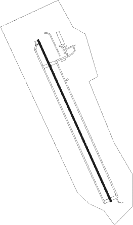
Runway info
| Runway 15 / 33 | ||
| length | 915m (3002ft) | |
| bearing | 157° / 337° | |
| width | 9m (30ft) | |
| surface | asphalt | |
Nearby beacons
| code | identifier | dist | bearing | frequency |
|---|---|---|---|---|
| CWK | CENTEX VORTAC | 15.6 | 120° | 112.80 |
| IL | IRESH (KILLEEN) NDB | 30.4 | 8° | 278 |
| GRK | GRAY (FORT HOOD) VOR/DME | 30.7 | 356° | 111.80 |
| RU | GARYS (AUSTIN) NDB | 34.8 | 196° | 272 |
| AGJ | GOOCH SPRINGS VORTAC | 43.9 | 332° | 112.50 |
| TPL | DME | 45.2 | 27° | 110.40 |
| STV | STONEWALL VORTAC | 51.4 | 251° | 113.80 |
| SAT | SAN ANTONIO VORTAC | 63.4 | 218° | 116.80 |
| DHK | RANDOLPH TACAN | 64.2 | 206° | 109.90 |
| AN | ALAMO (SAN ANTONIO) NDB | 68.4 | 221° | 368 |
| ROB | ROBINSON (WACO) NDB | 69.4 | 36° | 400 |
Disclaimer
The information on this website is not for real aviation. Use this data with the X-Plane flight simulator only! Data taken with kind consent from X-Plane 12 source code and data files. Content is subject to change without notice.