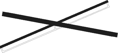
Battle Ground - Aretz
Airport details
| Country | United States of America |
| State | Indiana |
| Region | |
| Airspace | Chicago Ctr |
| Municipality | Tippecanoe County |
| Elevation | 616ft (188m) |
| Timezone | GMT -5 |
| Coordinates | 40.45896, -86.84006 |
| Magnetic var | |
| Type | land |
| Available since | X-Plane v10.40 |
| ICAO code | 3AR |
| IATA code | n/a |
| FAA code | n/a |
Communication
Nearby beacons
| code | identifier | dist | bearing | frequency |
|---|---|---|---|---|
| LA | EARLE (LAFAYETTE) NDB | 9.8 | 261° | 401 |
| BVT | BOILER (LAFAYETTE) VORTAC | 11.9 | 293° | 115.10 |
| CFJ | CRAWFORDSVILLE NDB | 28.9 | 189° | 388 |
| DN | JULIP (DANVILLE) NDB | 33.1 | 256° | 332 |
| GUS | GRISSOM (PERU) VORTAC | 33.3 | 75° | 108.45 |
| DNV | DANVILLE VORTAC | 34.2 | 257° | 111 |
| OKK | KOKOMO VORTAC | 35.9 | 85° | 113.50 |
| VHP | BRICKYARD VORTAC | 44.3 | 144° | 116.30 |
| UMP | METROPOLITAN (INDIANAPOLIS) NDB | 47.8 | 123° | 338 |
| FV | LAREZ (INDIANAPOLIS) NDB | 50 | 136° | 349 |
| OXI | KNOX VOR/DME | 52.5 | 12° | 115.60 |
| CO | COLFA (INDIANAPOLIS) NDB | 56.7 | 141° | 232 |
| VP | SEDLY (VALPARAISO) NDB | 59.6 | 358° | 212 |
| TTH | TERRE HAUTE VORTAC | 61.2 | 203° | 115.30 |
| EON | PEOTONE VORTAC | 65 | 310° | 113.20 |
Disclaimer
The information on this website is not for real aviation. Use this data with the X-Plane flight simulator only! Data taken with kind consent from X-Plane 12 source code and data files. Content is subject to change without notice.

