Post Mills
Airport details
| Country | United States of America |
| State | Vermont |
| Region | |
| Airspace | Boston Ctr |
| Municipality | Thetford |
| Elevation | 695ft (212m) |
| Timezone | GMT -5 |
| Coordinates | 43.87930, -72.25593 |
| Magnetic var | |
| Type | land |
| Available since | X-Plane v10.40 |
| ICAO code | 2B9 |
| IATA code | n/a |
| FAA code | 2B9 |
Communication
| Post Mills CTAF | 122.800 |
Nearby Points of Interest:
Peabody Library
-Post Mills Church
-Camp Billings
-Aloha Horizons Camp
-Aloha Hive Camp
-Ely Boston & Maine Railroad Depot
-Asa May House
-West Fairlee Center Church
-Moses Kent House
-Fairlee Railroad Depot
-Fairlee Town Hall
-Morey Memorial Bridge
-Lanakila Camp
-Root School
-Beaver Meadow School
-Piermont Bridge
-Beaver Meadow Union Chapel
-Sawyer-Medlicott House
-Foundry Bridge
-Hayward and Kibby Mill
-Tunbridge Village Historic District
-Norwich Mid-Century Modern Historic District
-South Tunbridge Methodist Episcopal Church
-Hanover Town Library
-Christian Street Rural Historic District
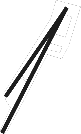
Runway info
Runway 04 / 22  | ||
| length | 885m (2904ft) | |
| bearing | 41° / 221° | |
| width | 24m (80ft) | |
| surface | grass | |
| Runway 05 / 23 | ||
| length | 676m (2218ft) | |
| bearing | 49° / 229° | |
| width | 24m (80ft) | |
| surface | grass | |
Nearby beacons
| code | identifier | dist | bearing | frequency |
|---|---|---|---|---|
| LAH | HANOVER (LEBANON) NDB | 11.1 | 156° | 276 |
| LEB | DME | 12.1 | 169° | 113.70 |
| MPV | MONTPELIER VOR/DME | 14.9 | 317° | 116.90 |
| CNH | CLAREMONT NDB | 31 | 193° | 233 |
| DYO | SMUTO (RUTLAND) NDB | 32.1 | 256° | 221 |
| RUT | DME | 36.8 | 243° | 111 |
| LC | BLNAP (LACONIA) NDB | 37.3 | 115° | 328 |
| GMA | MAHN (WHITEFIELD) NDB | 38 | 50° | 386 |
| CON | CONCORD VOR/DME | 49.4 | 134° | 112.90 |
| BTV | BURLINGTON VOR/DME | 50.6 | 299° | 117.50 |
| BJA | BURLINGTON TACAN | 52.8 | 304° | 112.40 |
| CO | EPSOM (CONCORD) NDB | 57.5 | 133° | 216 |
| BT | HERRO (BURLINGTON) NDB | 58 | 303° | 382 |
Disclaimer
The information on this website is not for real aviation. Use this data with the X-Plane flight simulator only! Data taken with kind consent from X-Plane 12 source code and data files. Content is subject to change without notice.