Liberty - Causey
Airport details
| Country | United States of America |
| State | North Carolina |
| Region | K7 |
| Airspace | Washington Ctr |
| Municipality | Guilford County |
| Elevation | 723ft (220m) |
| Timezone | GMT -5 |
| Coordinates | 35.91179, -79.61765 |
| Magnetic var | |
| Type | land |
| Available since | X-Plane v10.40 |
| ICAO code | 2A5 |
| IATA code | n/a |
| FAA code | n/a |
Communication
| CAUSEY CTAF/UNICOM | 122.800 |
Nearby Points of Interest:
Liberty Historic District
-Allen House
-Cedarock Park Historic District
-Dr. Joseph A. McLean House
-Marley House
-Randleman Graded School
-Former L. Richardson Memorial Hospital
-Union Cemetery
-William Fields House
-Agricultural and Technical College of North Carolina Historic District
-Lyndon Street Townhouses
-Downtown Greensboro Historic District
-Carolina Cadillac Company Building
-Elon College Historic District
-Johnston Hall
-Charles D. McIver School
-Sigmund Sternberger House
-L. Richardson Preyer Federal Building
-Guilford County Courthouse
-Wafco Mills
-Summit Avenue Historic District
-Central Fire Station
-Dixon-Leftwich-Murphy House
-Hillside
-Michael Sherwood House
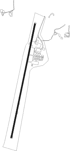
Runway info
| Runway 02 / 20 | ||
| length | 1130m (3707ft) | |
| bearing | 20° / 200° | |
| width | 12m (40ft) | |
| surface | hard surface | |
Nearby beacons
| code | identifier | dist | bearing | frequency |
|---|---|---|---|---|
| HB | ALAMM NDB | 4.2 | 26° | 361 |
| LIB | LIBERTY VORTAC | 6 | 177° | 113 |
| GSO | GREENSBORO VORTAC | 19.1 | 290° | 116.20 |
| IN | REENO (WINSTON SALEM) NDB | 28.3 | 286° | 317 |
| SIF | SLAMMER (REIDSVILLE) NDB | 29 | 343° | 423 |
| HUR | PERSON (ROXBORO) NDB | 33 | 60° | 220 |
| VU | ALLER (ALBEMARLE) NDB | 34 | 228° | 346 |
| RDU | RALEIGH-DURHAM VORTAC | 40.6 | 93° | 117.20 |
| DAN | DANVILLE VOR | 41.7 | 23° | 113.10 |
| SDZ | SANDHILLS (SOUTHERN PINES VORTAC | 41.8 | 178° | 111.80 |
| UV | BALES (MARTINSVILLE) NDB | 43.2 | 336° | 396 |
| LE | LEEVY (RALEIGH/DURHAM) NDB | 43.5 | 89° | 350 |
| RU | ROVDY (SALISBURY) NDB | 43.7 | 258° | 275 |
| POB | POPE (FAYETTEVILLE) NDB | 52.3 | 136° | 338 |
| POB | POPE (FAYETTEVILLE) TACAN | 53.3 | 141° | 113.80 |
| HXO | HUNTSBORO (OXFORD) NDB | 53.8 | 69° | 271 |
| HQT | HARNETT (ERWIN) NDB | 54.2 | 117° | 417 |
| SBV | SOUTH BOSTON VORTAC | 54.3 | 38° | 110.40 |
| FGP | FORT BRAGG NDB | 60.8 | 134° | 393 |
| FAY | FAYETTEVILLE VOR/DME | 66.4 | 141° | 108.80 |
Instrument approach procedures
| runway | airway (heading) | route (dist, bearing) |
|---|---|---|
| RW02 | CETOG (46°) | CETOG 3600ft CUPUS (5mi, 103°) 3000ft |
| RW02 | CUPUS (20°) | CUPUS 3000ft |
| RW02 | HORUN (351°) | HORUN 3000ft CUPUS (5mi, 283°) 3000ft |
| RNAV | CUPUS 3000ft BECAS (6mi, 20°) 2400ft 2A5 (5mi, 20°) 766ft (4901mi, 114°) 1140ft FEKIT (4899mi, 294°) 3000ft FEKIT (turn) | |
| RW20 | DICTE (226°) | DICTE 3000ft FEKIT (5mi, 283°) 3000ft |
| RW20 | EYOGI (171°) | EYOGI 3600ft FEKIT (5mi, 103°) 3000ft |
| RW20 | FEKIT (200°) | FEKIT 3000ft |
| RNAV | FEKIT 3000ft HOSIN (6mi, 200°) 2400ft 2A5 (5mi, 200°) 762ft (4901mi, 114°) 1140ft CUPUS (4903mi, 294°) 3000ft CUPUS (turn) |
Disclaimer
The information on this website is not for real aviation. Use this data with the X-Plane flight simulator only! Data taken with kind consent from X-Plane 12 source code and data files. Content is subject to change without notice.