Dayton - Mark Anton
Airport details
| Country | United States of America |
| State | Tennessee |
| Region | K7 |
| Airspace | Atlanta Ctr |
| Municipality | Rhea County |
| Elevation | 719ft (219m) |
| Timezone | GMT -5 |
| Coordinates | 35.48625, -84.93108 |
| Magnetic var | |
| Type | land |
| Available since | X-Plane v10.40 |
| ICAO code | 2A0 |
| IATA code | n/a |
| FAA code | 2A0 |
Communication
| Mark Anton AWOS 3 | 135.075 |
| Mark Anton CTAF/UNICOM | 123.000 |
| Mark Anton CHATTANOOGA Approach/Departure | 125.100 |
Nearby Points of Interest:
Broyles-Darwin House
-Dr. Walter Thomison House
-Blythe Ferry
-John Bridgman House
-Pikeville Chapel African Methodist Episcopal Zion Church
-Dr. James A. Ross House
-Bledsoe County Courthouse
-Bledsoe County Jail
-Rattlesnake Springs
-First United Presbyterian Church
-Hair Conrad Cabin
-Bellview School
-Craigmiles Hall
-W.J. Hughes Business House
-Broad Street United Methodist Church
-William Wiggins House
-Polk County Courthouse
-Sequatchie County Courthouse
-Cumberland Homesteads
-James County Courthouse
-Ocoee Dam No. 1
-Cumberland County Courthouse
-John McCroskey House
-Southern Railway 4501
-Seamour and Gerte Shavin House
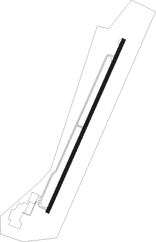
Runway info
| Runway 3 / 21 | ||
| length | 1527m (5010ft) | |
| bearing | 34° / 214° | |
| width | 30m (100ft) | |
| surface | asphalt | |
Nearby beacons
| code | identifier | dist | bearing | frequency |
|---|---|---|---|---|
| DTE | MARK ANTON (DAYTON) NDB | 0.2 | 178° | 394 |
| HCH | HINCH MTN (CROSSVILLE) VOR/DME | 17.8 | 351° | 117.60 |
| CQN | DAISY (N.CHATTANOOGA) NDB | 22.1 | 215° | 341 |
| GQO | CHOO CHOO (CHATTANOOGA) VORTAC | 33.3 | 203° | 115.80 |
| HEM | HUCHN NDB | 43.9 | 307° | 233 |
| SCX | SCOTT (ONEIDA) NDB | 60.5 | 19° | 403 |
Instrument approach procedures
| runway | airway (heading) | route (dist, bearing) |
|---|---|---|
| RW03 | CETPO (34°) | CETPO 3900ft |
| RW03 | FOSUV (62°) | FOSUV 5300ft CETPO (9mi, 97°) 3900ft |
| RW03 | YOPLU (0°) | YOPLU 6500ft CETPO (9mi, 313°) 3900ft |
| RNAV | CETPO 3900ft GEKCO (7mi, 33°) 2300ft WIRKA (3mi, 34°) 1440ft 2A0 (3mi, 34°) 742ft (5157mi, 113°) 961ft WATTZ (5152mi, 293°) 3900ft WATTZ (turn) | |
| RW21 | PECDI (241°) | PECDI 6300ft WATTZ (9mi, 277°) 3900ft |
| RW21 | WATTZ (214°) | WATTZ 3900ft |
| RW21 | WIXID (181°) | WIXID 5300ft WATTZ (9mi, 133°) 3900ft |
| RNAV | WATTZ 3900ft RUMBA (7mi, 214°) 2400ft HISMU (3mi, 214°) 1480ft 2A0 (3mi, 214°) 749ft (5157mi, 113°) 1010ft CETPO (5163mi, 293°) 3900ft CETPO (turn) |
Disclaimer
The information on this website is not for real aviation. Use this data with the X-Plane flight simulator only! Data taken with kind consent from X-Plane 12 source code and data files. Content is subject to change without notice.