Rockwall - Poetry Flying Ranch
Airport details
| Country | United States of America |
| State | Texas |
| Region | |
| Airspace | Ft Worth Ctr |
| Municipality | Hunt County |
| Elevation | 500ft (152m) |
| Timezone | GMT -6 |
| Coordinates | 32.86776, -96.22015 |
| Magnetic var | |
| Type | land |
| Available since | X-Plane v10.40 |
| ICAO code | 20TX |
| IATA code | n/a |
| FAA code | T48 |
Communication
| Poetry Flying Ranch CTAF | 123.000 |
Runway info
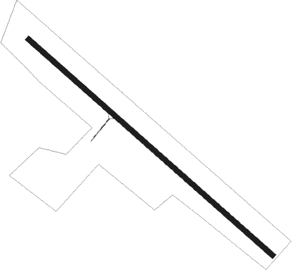
| Runway 13 / 31 | ||
| length | 1020m (3346ft) | |
| bearing | 131° / 311° | |
| width | 15m (50ft) | |
| surface | grass | |
Nearby beacons
| code | identifier | dist | bearing | frequency |
|---|---|---|---|---|
| MJF | ARVILLA (GREENVILLE) TACAN | 14.3 | 39° | 109.60 |
| PQF | MESQUITE NDB | 15.9 | 259° | 248 |
| GV | MAJOR (GREENVILLE) NDB | 19 | 28° | 201 |
| CVE | COWBOY (DALLAS) VOR/DME | 34.5 | 272° | 116.20 |
| SLR | SULPHUR SPRINGS VOR/DME | 39.4 | 64° | 109 |
| BYP | BONHAM VORTAC | 40.2 | 359° | 114.60 |
| CQY | CEDAR CREEK VORTAC | 40.9 | 180° | 114.80 |
| TTT | MAVERICK VOR/DME | 41.3 | 270° | 113.10 |
| UIM | DME | 43 | 89° | 114 |
| FUZ | RANGER (DALLAS-FORT WORTH VORTAC | 48.4 | 271° | 115.70 |
| CGQ | POWELL (CORSICANA) NDB | 49.3 | 194° | 344 |
| CSZ | CROSSROADS NDB | 50.1 | 162° | 215 |
| CRS | CORSICANA NDB | 51.1 | 192° | 396 |
| TYR | TYLER VOR/DME | 51.4 | 122° | 114.20 |
| DT | PINCK (DENTON) NDB | 55 | 293° | 257 |
| PRX | PARIS VOR/DME | 56 | 49° | 113.60 |
| FZT | FRANKSTON VOR/DME | 59 | 139° | 111.40 |
| DNI | DENISON (SHERMAN-DENISON) NDB | 61.8 | 335° | 341 |
Disclaimer
The information on this website is not for real aviation. Use this data with the X-Plane flight simulator only! Data taken with kind consent from X-Plane 12 source code and data files. Content is subject to change without notice.