Fremont
Airport details
| Country | United States of America |
| State | Ohio |
| Region | K5 |
| Airspace | Cleveland Ctr |
| Municipality | Sandusky County |
| Elevation | 663ft (202m) |
| Timezone | GMT -5 |
| Coordinates | 41.33308, -83.16119 |
| Magnetic var | |
| Type | land |
| Available since | X-Plane v10.40 |
| ICAO code | 14G |
| IATA code | n/a |
| FAA code | n/a |
Communication
| Fremont CTAF/UNICOM | 122.800 |
| Fremont TOLEDO Approach/Departure | 126.100 |
Nearby Points of Interest:
Soldiers and McKinley Memorial Parkways
-Spiegel Grove
-Joseph and Rachel Bartlett House
-Sandusky County Jail and Sheriff's House
-Frederick Fabing House
-Michaels Farm
-Christopher C. Layman Law Office
-Georg Cronenwett House
-Aigler Alumni Building
-The Octagon
-Bagby-Hossler House
-Old School Privy
-John Wright Mansion
-No. 5 Fire Station
-Engine House No. 1
-Zion Episcopal Church
-John Mertz House
-St. Mary's Rectory
-Odd Fellows Hall
-Erie County Jail
-Carnegie Library
-Johnson's Island
-John Stang House
-Eleutheros Cooke House
-Adams Street Double House
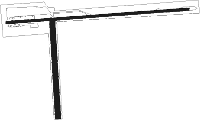
Runway info
Runway 9 / 27  | ||
| length | 1262m (4140ft) | |
| bearing | 90° / 270° | |
| width | 18m (60ft) | |
| surface | asphalt | |
| displ threshold | 39m (128ft) / 0m (0ft) | |
| Runway 18 / 36 | ||
| length | 683m (2241ft) | |
| bearing | 181° / 1° | |
| width | 40m (130ft) | |
| surface | grass | |
Nearby beacons
| code | identifier | dist | bearing | frequency |
|---|---|---|---|---|
| TII | TIFFIN NDB | 14.5 | 193° | 269 |
| PCW | PORT CLINTON NDB | 17.2 | 58° | 423 |
| TOL | TOLEDO TACAN | 32.7 | 292° | 112.50 |
| FBC | FLAG CITY VORTAC | 35.1 | 238° | 108.20 |
| TO | TOPHR (TOLEDO) NDB | 36.6 | 286° | 219 |
| MFD | MANSFIELD VORTAC | 38 | 129° | 108.80 |
| BUD | BUCKEYE (MARION) VOR | 43.2 | 172° | 109.80 |
| CRL | CARLETON VOR/DME | 44.9 | 337° | 115.70 |
| DJB | DRYER VOR/DME | 45 | 89° | 113.60 |
| RYS | GROSSE ILE (DETROIT) NDB | 46.1 | 1° | 419 |
| MF | MANNS (MANSFIELD) NDB | 47 | 128° | 372 |
| DT | REVUP (DETROIT) NDB | 48.7 | 341° | 388 |
| ADG | ADRIAN NDB | 52.2 | 300° | 278 |
| TCU | TECUMSEH NDB | 53.1 | 314° | 239 |
| DM | SPENC (DETROIT) NDB | 53.2 | 357° | 223 |
| DXO | DETROIT VOR/DME | 53.6 | 347° | 113.40 |
| QG | WINDSOR NDB | 60.2 | 17° | 353 |
Instrument approach procedures
| runway | airway (heading) | route (dist, bearing) |
|---|---|---|
| RW09 | HALOK (112°) | HALOK KADBY (7mi, 180°) 2600ft |
| RW09 | KADBY (90°) | KADBY 2600ft |
| RW09 | TUMAY (68°) | TUMAY KADBY (7mi, 0°) 2600ft |
| RNAV | KADBY 2600ft FALWA (7mi, 90°) 2400ft 14G (6mi, 91°) 693ft (5097mi, 116°) 1063ft KADBY (5110mi, 296°) 2600ft KADBY (turn) |
Disclaimer
The information on this website is not for real aviation. Use this data with the X-Plane flight simulator only! Data taken with kind consent from X-Plane 12 source code and data files. Content is subject to change without notice.