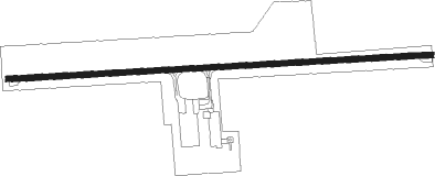
Brazil - Brazil Clay County
Airport details
| Country | United States of America |
| State | Indiana |
| Region | |
| Airspace | Indianapolis Ctr |
| Municipality | Clay County |
| Elevation | 645ft (197m) |
| Timezone | GMT -5 |
| Coordinates | 39.47674, -87.09972 |
| Magnetic var | |
| Type | land |
| Available since | X-Plane v10.40 |
| ICAO code | 0I2 |
| IATA code | n/a |
| FAA code | 0I2 |
Communication
| Brazil Clay County CTAF/UNICOM | 122.800 |
Nearby beacons
| code | identifier | dist | bearing | frequency |
|---|---|---|---|---|
| TTH | TERRE HAUTE VORTAC | 6.9 | 275° | 115.30 |
| HU | YINNO (TERRE HAUTE) NDB | 14.8 | 253° | 245 |
| OOM | HOOSIER (BLOOMINGTON) VORTAC | 30.1 | 124° | 110.20 |
| CFJ | CRAWFORDSVILLE NDB | 31.4 | 20° | 388 |
| PLX | PALESTINE (ROBINSON) NDB | 37.5 | 230° | 391 |
| VHP | BRICKYARD VORTAC | 39.4 | 65° | 116.30 |
| CO | COLFA (INDIANAPOLIS) NDB | 43.6 | 79° | 232 |
| FV | LAREZ (INDIANAPOLIS) NDB | 45.7 | 71° | 349 |
| LWV | DME | 48.5 | 215° | 108.80 |
| DN | JULIP (DANVILLE) NDB | 52.6 | 332° | 332 |
| DNV | DANVILLE VORTAC | 53.4 | 331° | 111 |
| LA | EARLE (LAFAYETTE) NDB | 57 | 3° | 401 |
Instrument approach procedures
| runway | airway (heading) | route (dist, bearing) |
|---|---|---|
| RW27 | CLOTT (256°) | CLOTT HADNO (7mi, 229°) 3200ft |
| RW27 | KELLY (278°) | KELLY HADNO (9mi, 287°) 3200ft |
| RW27 | TTH (95°) | TTH HADNO (18mi, 92°) 3200ft HADNO (turn) 3200ft |
| RNAV | HADNO 3200ft CESAP (6mi, 271°) 2300ft 0I2 (5mi, 271°) 673ft (5271mi, 114°) 2300ft HADNO (5260mi, 294°) 3200ft HADNO (turn) |
Disclaimer
The information on this website is not for real aviation. Use this data with the X-Plane flight simulator only! Data taken with kind consent from X-Plane 12 source code and data files. Content is subject to change without notice.
