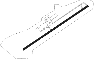
Glenmoor - Columbiana Co
Airport details
| Country | United States of America |
| State | Ohio |
| Region | K5 |
| Airspace | Cleveland Ctr |
| Municipality | Columbiana County |
| Elevation | 1160ft (354m) |
| Timezone | GMT -5 |
| Coordinates | 40.67334, -80.64468 |
| Magnetic var | |
| Type | land |
| Available since | X-Plane v10.40 |
| ICAO code | 02G |
| IATA code | n/a |
| FAA code | n/a |
Communication
| Columbiana Co CTAF/UNICOM | 123.000 |
| Columbiana Co PITTSBURGH Approach/Departure | 124.750 |
Nearby beacons
| code | identifier | dist | bearing | frequency |
|---|---|---|---|---|
| EWC | ELLWOOD CITY VOR/DME | 21.7 | 71° | 115.80 |
| MMJ | (PITTSBURGH) DME | 23.3 | 112° | 112 |
| UCP | CASTLE (NEW CASTLE) NDB | 23.4 | 33° | 272 |
| HLG | WHEELING VOR/DME | 25 | 170° | 112.20 |
| CFX | CADIZ NDB | 31.1 | 220° | 239 |
| YN | FETCH (YOUNGSTOWN/WARREN) NDB | 31.7 | 5° | 338 |
| BSV | BRIGGS VOR/DME | 36 | 275° | 112.40 |
| ACO | AKRON VOR/DME | 36.3 | 308° | 114.40 |
| AGC | ALLEGHENY (PITTSBURGH) VOR/DME | 36.3 | 123° | 110 |
| YNG | YOUNGSTOWN VORTAC | 39.5 | 357° | 109 |
| AIR | BELLAIRE VOR/DME | 40.2 | 195° | 117.10 |
| AK | AKRON NDB | 41.2 | 298° | 362 |
| CTW | DME | 46.4 | 242° | 111.80 |
| CXR | CHARDON VOR/DME | 55.8 | 328° | 112.70 |
| FKL | FRANKLIN VOR | 58.1 | 46° | 109.60 |
| VV | CAMOR (CONNELLSVILLE) NDB | 62.8 | 131° | 299 |
| BF | TABEY (CLEVELAND) NDB | 68.2 | 314° | 248 |
Instrument approach procedures
| runway | airway (heading) | route (dist, bearing) |
|---|---|---|
| RW25 | CUTTA (180°) | CUTTA VEKTE (8mi, 103°) 3000ft FEYPU (5mi, 144°) 3000ft |
| RW25 | EWC (251°) | EWC FEYPU (10mi, 254°) 3000ft |
| RNAV | FEYPU 3000ft ITUHU (6mi, 247°) 2800ft 02G (5mi, 247°) 1200ft (4980mi, 117°) 1560ft CUTTA (4981mi, 297°) 3000ft CUTTA (turn) |
Disclaimer
The information on this website is not for real aviation. Use this data with the X-Plane flight simulator only! Data taken with kind consent from X-Plane 12 source code and data files. Content is subject to change without notice.
